| Home | Rides | Reviews | Bikes | Gallery | Tech | Misc | Contact |
| T4
- The East-West Tour
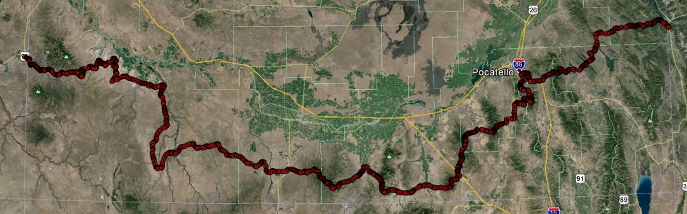
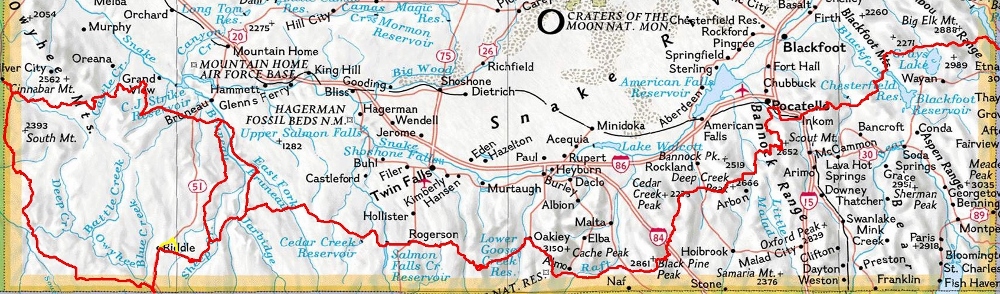
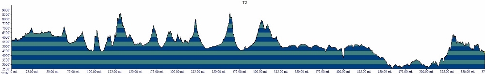
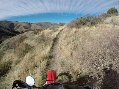
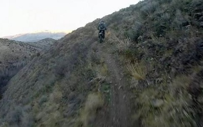
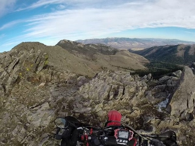
of Idaho Five hundred fifty enjoyable riding miles, dual sport possible, great variety, brain burning scenery - and it all kinda looks like a big old smiley face on the map. What's not to like? The Tour of Idaho, T4 version, begins in the shadow of the Tetons and traverses the basin and range region of southern Idaho to the great Owyhee Desert. The overall length of T4 is about 550 miles (more or less - depending on the exact route taken) and encompasses dirt roads (45%), Jeep/ATV trails (30%), single track (15%) and pavement (10%). T4 is more than simply a practice ride for The Tour of Idaho (T1). It is a wonderful adventure in it's own right. It is much simpler (and less expensive) to arrange logistics for T4, and it requires far less time to complete. There are no challenge points and you are welcome to improvise your own variants. Camping opportunities are plentiful. Though street legal dirt bikes are recommended, T4 is appropriate for most bikes with reasonable off-road capability. Idaho has new rules governing OHV's. If your bike is plated out of state you should be fine. Check here for OHV requirements in Idaho. Though not as remote or rugged as The Tour of Idaho, (T1), or as long as the dual sport T3, much of the two plus days required to complete T4 (at anything less than a race pace) is spent far from civilization. Cell phones are largely useless. Water, food, emergency supplies and fuel must be carried and bikes must be capable of a 200+ mile range if the most remote variants are taken. A Garmin inReach or similar beacon (or sat phone) is highly recommended. T4 encompasses elevations from 8500' to 2000' and traverses through environments including mountain passes, forests, marshlands and deserts. We have encountered everything from mountain lions to wolves to wild horses along the way. T4 is generally passable by early June (depending on the variant taken) and remains ridable through early November most years. Maps, directions and the route gps are provided below. Maps: .gpx, 500K Map, East 100k, West 100k |
|


|
|
 |
|
|
 |
|
|
 |
|
|
|
Two starts are available. For the adventurous we recommend the doing the first day of T1 and hooking up with T4 just east and south of Pocatello. This variation makes T4 a great three-day adventure. This variation, however, is not a dual sport route. The traditional T4, which is more dual sport friendly, begins in a parking area on US 89 on the southern end of Palisades Reservoir, about a mile south of Alpine Junction, Wyoming. From the parking lot, follow NFD 087 around the southern end of the reservoir, then northwest to the McCoy Creek Campground where the road turns west and heads into the mountains. From here NFD 087 winds some 16 miles through Caribou Basin to an intersection with Grays Lake Road at Herman on the northeastern edge of Grays Lake National Wildlife Refuge. Turn right (north) and follow Grays Lake Road west some 5 miles to an intersection with Cranes Flat Road. Turn left (southwest) and proceed mostly southwest 11 miles to an intersection with Bone Rd. Turn left (south) and proceed 5 miles to the northern edge of Blackfoot Reservoir. Turn right at the bottom of the hill on the northern shores of the reservoir onto Government Dam Road. Follow this around the northwest end of the reservoir a few miles to a bridge crossing the Blackfoot River. From this bridge proceed south along Government Dam road 0.6 miles to an intersection with Corral Creek Road on the right (west). Follow this 3 miles to a intersection with Cow Camp Road on the left (south). |
 |
 |
Cow Camp Road winds 11 miles
southwest up and over
the scenic crest of the Chesterfield Range (7100') and
down into the historic Chesterfield settlement. Head west
along
Chesterfield Road 1.5 miles beyond Chesterfield, then jog
right
(north)
0.5 miles to an intersection with Kelly Toponce Road. Turn
left and head west 2.75 miles where Kelly Toponce Road swings to the
south. Continue another half mile to an intersection with Toponce
Canyon Road on the right (west). The route out of Inkom proceeds north along old US 91 about 8 miles to Blackrock Canyon - a well-known OHV area outside of Pocatello. Go underneath I-15 and take the immediate left. This leads to a spectacular ridge trail that heads north toward Chinese Peak and Pocatello. |
|
The Tour of Idaho Flagpole is 3 miles below the top of Chinese Peak, about 100 yards after the dirt road turns to pavement, on the left.
The route out of Pocatello follows T1
(mostly) along the Slate
Mtn., Lead Draw, Crestline, Valve House and Racetrack trails to South
Fork Road. Turn left here, and follow farm roads to Mink Creek Road.
Turn left (south) and proceed
several miles to an intersection with Lusk Loop on the left. Follow
Lusk Loop south then west to an intersection with Arbon
Valley Road. Cross Arbon Valley Road and go another 0.5 miles to an
intersection with Bailey Road. Turn left (south) and follow Bailey Road
a mile or so to Knox Canyon Road. |
 |
 |
Turn left and follow NFD 579 as it
winds south for a couple of miles to
Hartley Canyon Road. Turn right (south) and go about 0.1 miles to
Sublett Creek Road on the right (southwest). Follow this about 6 miles
to Beaver Dam Canyon on the left (south). Proceed south and
west to Meadows Creek and Sweetzer Road. From Sweetzer Road, head south and west several miles along NFD768 climbing the northeastern flank of Black Pine Mountain . You will encounter a sign that says "No Maintenance" near the top of a hill. From here you have two options. The first involves a steep (1500'/mile), spectacular climb up a poor trail that gets progressively steeper. The second involves a longer trip around the north end of Black Pine Mountain (the best option for east to west riders). For option 1, turn left and head south a mile or so along an old road. At the top of a pass you will encounter an old pole on your left. Turn right and head steeply uphill to the crest of Black Pine Mountain. At the ridge crest, turn south (left) and follow the ridge for a bit, then head west to Kelsaw Canyon. At the west end of the canyon, proceed 7 miles west and north to State Hwy 81. Head west another 5 miles across the Raft River Valley to EY Road. |
| Follow
EY road 7 miles west to an intersection with Narrows Road on the left
(south). Go west 7 miles to Almo Road. Turn right (north) and proceed
one mile north into Almo where gas, food and lodging are available. The
route out of Almo heads back south of City of Rocks Road on the right
(west) just south of town. Follow City of Rocks Road west 4 miles to an intersection. Turn right and continue north along City of Rocks Road 2.4 miles to a road on the right. Turn right and follow this road north along the mountains some 13 miles to an intersection with Birch Creek Road, a few miles outside of Oakley. Gas and food are available in Oakley during daylight hours. Take South College Street out of Oakley which turns into 500W. Two miles south of Oakley, the route turns right (west) onto 2200 South. After 0.5 miles turn left (south) onto 600S. After another 0.5 miles veer right (west) onto Trapper Creek Road/NFD 533. Proceed around the north side of Lower Goose Creek Reservoir some 15 miles southwest to an intersection with NFD 538/Monument Peak Road on the right (north). From here the route climbs 4 miles to the summit of Monument Peak (8000') and it's commanding view of the South Hills (Note: The road across Monument Peak is often blocked by snow drifts until late in the year. This is easily bypassed via ATV trails on either the north or south). Continue north another few miles Porcupine Spring, just south of Magic Mountain Ski area. |
|
 |
Head
west along a series of trails and Jeep roads to Deadline Ridge, then
north to Shoshone Basin/Magic Mountain Road. Follow this (with one
short cut) west about 20 miles to US 93 and the town of Rogerson. Gas
and food are available at Rogerson. From Rogerson it is possible to ride 19 miles south on US 93 to the casino resort town of Jackpot, Nevada, where one will find relatively luxurious dining, lodging and gambling - if that's your game. Load up with gas at Rogerson as it's the last chance for quite a while. From Rogerson proceed west 8 miles west to Salmon Falls Creek Reservoir. Go west another 2 miles along Three Creek Road to to Antelope Spring - Roseworth Road on the right (north). Proceed northwest about 3 miles to a nondescript road that heads west down into Cedar Creek. Follow this road about 3/4 of a mile down into the canyon. Proceed south for about a mile down the canyon to a hairpin that heads back to the north and out the west side of the canyon. At the canyon's rim turn left (south) onto a series of roads that parallel Cedar Creek. |
| After
a few miles turn right (west)
just
west of Three Mile crossing and continue northwest another five or so
miles
to an intersection with House
Creek Road. Turn right (northeast) and proceed 0.5 miles to another
intersection on the left. Turn left (northwest) and proceed 7 miles
to Devil Creek and Big Bend Crossing. Head west 4 miles to a "T"
intersection. Turn right (northeast) and go 0.5 miles. Turn left
(northwest) and proceed 7 miles toward Horse Butte At Horse Butte, turn
left and proceed 5 miles to the East Fork Bruneau Canyon crossing, then
2 miles further west to an intersection with Clover
Three Creek Road. Continue west another 13 miles to an intersection and
a decision. From here you have several choices. North or South? East or West of the Bruneau? The northern route, which may be followed east or west of the Bruneau Canyon, has better technical riding, and is scenic. The southern route traverses some of the most remote terrain in the USA and crosses two spectacular river canyons. Personally I prefer the northern route, west of the Bruneau, but only because I've had the opportunity to do them all. If you decide to follow the southern route, be sure to check the water levels on the Owyhee (check with the gaging station at Rome, OR). The ford is likely to be very difficult and dangerous to cross early in the season (until July in most years). To stay east of the Bruneau, turn right and proceed north 14 miles through the Inside Desert along the Idaho Centennial trail to Winter Camp. Head north and west another 23 miles (be sure to stop at the Bruneau Canyon Overlook 14 miles north of Winter Camp) to an intersection with Hot Springs Road on the Bruneau River. From Hot Springs Road it is 7.5 miles to Bruneau. There are two gas station/convenience stores in Bruneau (one of which has a small attached motel), but no 24 hour pumps. Bruneau is the easiest gas available in this area of the Tour. Another way to the northern route is along the western edge of the Bruneau Canyon. This variant crosses the Bruneau at Indian Hot Springs (an awesome ride), then 10 or so miles to the abandoned town of Grasmere. From here it's 32 miles northeast along the Blackstone Grasmere road to Hot Springs Road. |
 |
 |
Hot Springs
Road heads west to an intersection with with Sugar Valley
Road. Turn right (north) and
proceed north then west along Sugar Valley Road some 9 miles
to an
intersection with ID 51. From here it is possible to proceed about 8
miles north to Bruneau for gas before 7
p.m. Proceed west across ID 51 to Shoofly Cutoff Road. Follow Shoofly Cutoff Road northwest approximately 10 miles to an intersection with Poison Creek Road. From here it is possible to proceed about 8.5 miles north to Grandview for gas 24/7. If you go to Grandview, take Whilted Ln. south out of town to Vinson Wash, then ride up the wash to reconnect with the route. Turn right (north) on Poison Creek Road and look for the first gate on the left (west) side of the road. You are entering the heart of the Owyhee Desert. For the next 50 miles you'll follow sand washes and single track, generally west, toward the looming Owyhee Mountains. For the most part the route is obvious. If you find yourself wandering too far from the gpx track (which is approximate, in places), it's easy to boondock it back to the proper trail. This section is remote, hot, and not for those adverse to riding whooped out sand washes. It is my favorite section of T4, but your mileage may vary. |
| Proceed
through the gate and head west up a sand wash, over a range of low
hills, then down into a valley 4 miles to a trail on the right
that heads
steeply uphill. Head north about 23 miles to a road crossing, then
another mile or so to McKeeth Wash. Turn left and head southwest 5
miles down McKeeth wash to a gully on the right. Head up this gully
about 100 yards, then follow a single track trail west along a ridge
that parallels the wash below and left a few miles to Castle
Creek Road. Head a few more miles north and west along interspersed single track and sand washes to Castle Creek at the base of the Owyhee Mountains. From here it's about 50 miles of jeep trail and farm road, crossing the Owyhee's, to Jordan Valley. The southern variation of T4 rocks - literally! After climbing out of the west side of the Bruneau Canyon follow a series of nondescript desert roads south and west about 20 miles to Rowland Road. Continue from Rowland Road west and south along Antelope Creek to the town of Riddle on ID 51. Riddle has a general store that has gas when it's open (not often). It is possible to head west from Riddle to Garat Crossing on the Owyhee but this isn't recommended until late in the season (and even then not highly). |
 |
 |
Otherwise, from Riddle it's
15 miles south
along ID 51 to Mountain View Lake where the route leaves the pavement
and heads west. Please note that you are in
the Duck Valley
Reservation and should not leave marked roads. Another mile
south along ID 51 is a fully equipped gas station
and deli which you will need to visit for gas. The road west skirts the southern end of the Blue Creek Marsh, crossing the Owyhee just north of Pleasant Valley Road. Jog south to BIA904/State Line Road which is followed west for about 10 miles to an intersection with 45 Ranch Road. Follow this west, then north then northwest some 30 miles across the YP desert before turning north toward the Crutcher Crossing on the Owyhee. Next climb north out of the Owyhee Canyon and proceed north along a jeep trail 10 miles through Bull Basin and then to Bedstead Ridge. Another 10 spectacular miles north over Juniper Mountain and the route intersects with the Owyhee Uplands Back Country Scenic Byway/Juniper Mountain Road which leads west and north some 40 miles into Jordan Valley. |
|
Fuel availability (along the recommended route):
|
 |
Photos/Images/Maps
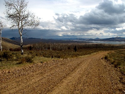
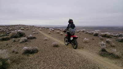
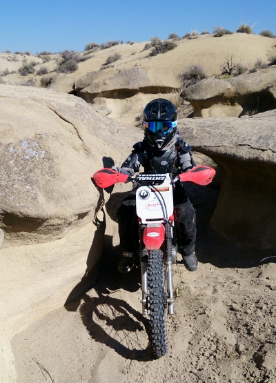
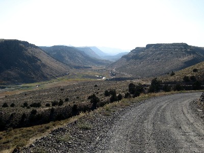
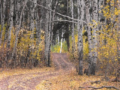
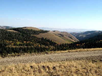
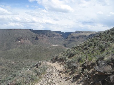
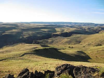
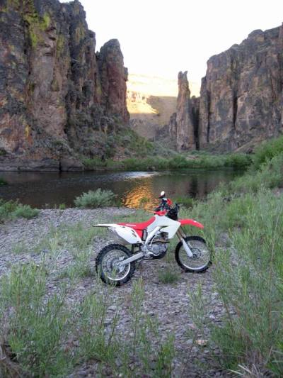
- Martin Hackworth, JR Hackworth, Dan Colvin 1. TOPO image (map) 2. Google Earth Image 3. TOPO image (map) 4. TOPO image (profile) 5. Blackfoor Reservoir 6. Slate Mountain 7. Slate Mountain 8. Scout Mountain 9. Scout Mountain 10. Owyhee Desert, Grandview |
| 11. Owyhee Desert, Grandview 12. Trapper Creek 13. Badger Gulch 14. Monument Peak 15. Bruneau Crossing 16. Bruneau Overlook 17. Owyhee River Canyon 18. Owyhee Canyon, Crutcher Crossing Check out our Tour of Idaho Video Library   |
 |
 |
Related Story: T4 2009 Additional Resources:
Reader Forum |
| Home | Rides | Reviews | Bikes | Gallery | Tech | Misc | Contact |